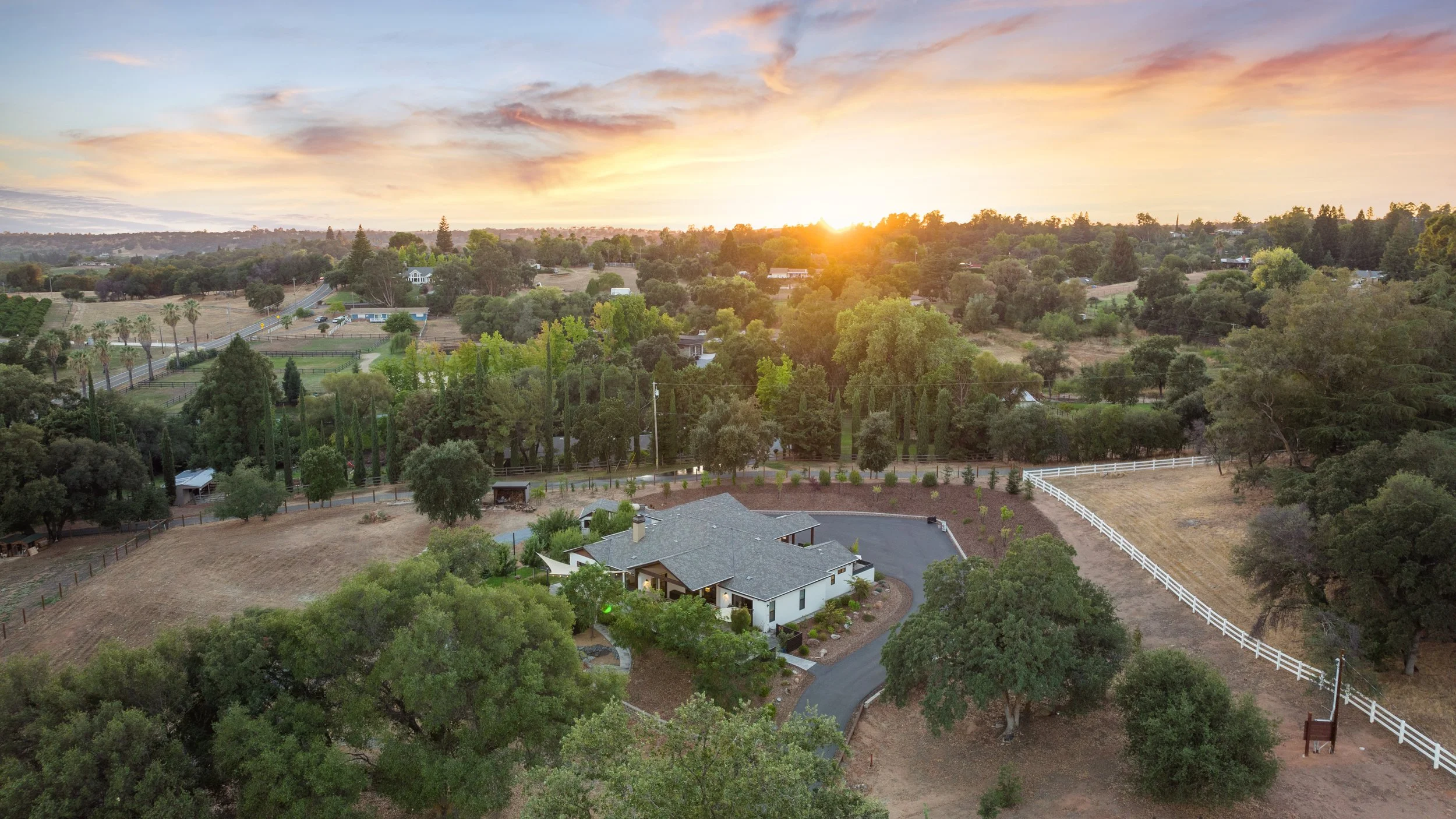
Drone photography can explain a property's setting in a way ground-level photographs cannot. It can show how a house relates to its yard, how buildings sit on a larger parcel, or how an outdoor area connects to the home. Responsible planning comes before the flight.
Commercial work needs a qualified operator
Real estate drone work is business activity. The FAA's Part 107 framework generally governs small commercial drone operations, including pilot qualification and operational limits. A homeowner's permission does not replace airspace authorization. Flights in controlled airspace may require FAA approval, and night operations have additional conditions.
Agents should ask the provider how airspace, site conditions, and the planned operation will be checked. Avoid promising a seller a particular flight path, height, or time before the operator has assessed the address.
Plan for weather and the surroundings
Wind, rain, visibility, temporary restrictions, nearby activity, and safe launch access can change whether a flight is appropriate. The operator must be able to make that decision on the day. A useful marketing schedule leaves room for an alternative angle or a later aerial session when needed.
- Share the exact property address before the appointment.
- Identify access limitations and where a safe launch may be possible.
- Tell the team about construction, events, livestock, or unusual activity.
- Coordinate with the owner without assuming control over neighboring land.
- Keep people clear of the operating area as directed.
Respect the neighborhood
Frame the property and the context buyers need. Avoid unnecessary attention to neighboring windows, private yards, or people. A drone image should communicate the listing, not turn the neighborhood into a spectacle. Property-line graphics also require care: use verified information and identify approximations rather than presenting a drawn line as a survey.
Choose aerials with a purpose
A lower, angled view may explain the home and yard better than a very high roof photograph. An overhead image can help with layout; a wider view can provide setting. The right mix depends on the property and the lawful, safe options available.
House Cat Marketing offers drone photography and video as part of a coordinated listing-media plan. Review package inclusions and share your address and priorities early. We can discuss useful coverage without building the launch around a flight that has not been assessed.
Sources: FAA commercial drone operations and airspace authorizations. Check current requirements for the proposed operation.